Unmanned aerial vehicle and proximal sensing of vegetation indices in olive tree (Olea europaea)

Published: 12 October 2023
Abstract Views: 833
PDF: 322
HTML: 22
Publisher's note
All claims expressed in this article are solely those of the authors and do not necessarily represent those of their affiliated organizations, or those of the publisher, the editors and the reviewers. Any product that may be evaluated in this article or claim that may be made by its manufacturer is not guaranteed or endorsed by the publisher.

Authors

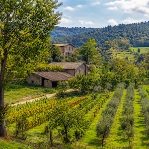
Remote and proximal sensing platforms at the service of precision olive growing are bringing new development possibilities to the sector. A proximal sensing platform is close to the vegetation, while a remote sensing platform, such as unmanned aerial vehicle (UAV), is more distant but has the advantage of rapidity to investigate plots. The study aims to compare multispectral and hyperspectral data acquired with remote and proximal sensing platforms. The comparison between the two sensors aims at understanding the different responses their use can provide on a crop, such as olive trees having a complex canopy. The multispectral data were acquired with a DJI multispectral camera mounted on the UAV Phantom 4. Hyperspectral acquisitions were carried out with a FieldSpec® HandHeld 2™ Spectroradiometer in the canopy portions exposed to South, East, West, and North. The multispectral images were processed with Geographic Information System software to extrapolate spectral information for each cardinal direction’s exposure. The three main Vegetation indices were used: normalized difference vegetation index (NDVI), normalized difference red-edge index (NDRE), and modified soil adjusted vegetation index (MSAVI). Multispectral data could describe the total variability of the whole plot differentiating each single plant status. Hyperspectral data were able to describe vegetation conditions more accurately; they appeared to be related to the cardinal exposure. MSAVI, NDVI, and NDRE showed correlation r =0.63**, 0.69**, and 0.74**, respectively, between multispectral and hyperspectral data. South and West exposures showed the best correlations with both platforms.

Dimensions

Altmetric

PlumX Metrics

Downloads

Download data is not yet available.

Citations

Álamo S., Ramos M., Feito F., Cañas A. 2012. Precision techniques for improving the management of the olive groves of southern Spain. Span. J. Agric. Res. 583-95. DOI: https://doi.org/10.5424/sjar/2012103-361-11
Anifantis A.S., Camposeo S., Vivaldi G.A., Santoro F., Pascuzzi S. 2019. Comparison of UAV photogrammetry and 3D modeling techniques with other currently used methods for estimation of the tree row volume of a super-high-density olive orchard. Agriculture 9:233. DOI: https://doi.org/10.3390/agriculture9110233
Avola G., Di Gennaro S.F., Cantini C., Riggi E., Muratore F., Tornambè C., Matese A. 2019. Remotely sensed vegetation indices to discriminate field-grown olive cultivars. Remote Sens. 11:1242. DOI: https://doi.org/10.3390/rs11101242
Benelli A., Cevoli C., Fabbri A. 2020. In-field hyperspectral imaging: An overview on the ground-based applications in agriculture. J Agric. Eng. 51:129-39. DOI: https://doi.org/10.4081/jae.2020.1030
Ben-Gal A., Agam N., Alchanatis V., Cohen Y., Yermiyahu U., Zipori I., Presnov E., Sprintsin M., Dag A. 2009. Evaluating water stress in irrigated olives: correlation of soil water status, tree water status, and thermal imagery. Irrig. Sci. 27:367-76. DOI: https://doi.org/10.1007/s00271-009-0150-7
Berni J., Zarco-Tejada P., Sepulcre-Cantó G., Fereres E., Villalobos F. 2009. Mapping canopy conductance and CWSI in olive orchards using high resolution thermal remote sensing imagery. Remote Sens. Environ. 113:2380-8. DOI: https://doi.org/10.1016/j.rse.2009.06.018
Campos I., Neale C.M., Calera A. 2017. Is row orientation a determinant factor for radiation interception in row vineyards? Aust. J. Grape Wine Res. 23:77-86. DOI: https://doi.org/10.1111/ajgw.12246
Caruso G., Zarco-Tejada P.J., González-Dugo V., Moriondo M., Tozzini L., Palai G., Rallo G., Hornero A., Primicerio J., Gucci R. 2019. High-resolution imagery acquired from an unmanned platform to estimate biophysical and geometrical parameters of olive trees under different irrigation regimes. PloS one 14:e0210804. DOI: https://doi.org/10.1371/journal.pone.0210804
Catania P., Comparetti A., Febo P., Morello G., Orlando S., Roma E., Vallone M. 2020. Positioning accuracy comparison of GNSS receivers used for mapping and guidance of agricultural machines. Agronomy. 10:924. DOI: https://doi.org/10.3390/agronomy10070924
Catania P., Orlando S., Roma E., Vallone M. 2019. Vineyard design supported by GPS application. Int. Symp. pp. 227-233. DOI: https://doi.org/10.17660/ActaHortic.2021.1314.29
Deng L., Mao Z., Li X., Hu Z., Duan F., Yan Y. 2018. UAV-based multispectral remote sensing for precision agriculture: A comparison between different cameras. ISPRS J Photogramm. Remote Sens. 146:124-36. DOI: https://doi.org/10.1016/j.isprsjprs.2018.09.008
Dorigo W.A., Zurita-Milla R., de Wit A.J., Brazile J., Singh R., Schaepman M.E. 2007. A review on reflective remote sensing and data assimilation techniques for enhanced agroecosystem modeling. Int. J. Appl. Earth Observ. Geoinf. 9:165-93. DOI: https://doi.org/10.1016/j.jag.2006.05.003
Er-Rami M., D’Urso G., Lamaddalena N., D’Agostino D., Belfiore O.R. 2021. Analysis of irrigation system performance based on an integrated approach with Sentinel-2 satellite images. J. Agric. Eng. 52. DOI: https://doi.org/10.4081/jae.2021.1170
Gómez J., Zarco‐Tejada P., García‐Morillo J., Gama J., Soriano M. 2011. Determining Biophysical Parameters for Olive Trees Using CASI‐Airborne and Quickbird‐Satellite Imagery. Agron. J. 103:644-54. DOI: https://doi.org/10.2134/agronj2010.0449
Gómez-Casero M.T., López-Granados F., Pena-Barragán J.M., Jurado-Expósito M., García-Torres L., Fernández-Escobar R. 2007. Assessing nitrogen and potassium deficiencies in olive orchards through discriminant analysis of hyperspectral data. J. Ame. Soc. Hortic. Sci. 132:611-8. DOI: https://doi.org/10.21273/JASHS.132.5.611
Jensen J.R. 2009. Remote sensing of the environment: An earth resource perspective 2/e. Pearson Education, India.
Jiménez-Brenes F.M., López-Granados F., De Castro A., Torres-Sánchez J., Serrano N., Peña J. 2017. Quantifying pruning impacts on olive tree architecture and annual canopy growth by using UAV-based 3D modelling. Plant Methods. 13:1-15. DOI: https://doi.org/10.1186/s13007-017-0205-3
Kottek M., Grieser J., Beck C., Rudolf B., Rubel F. 2006. World map of the Köppen-Geiger climate classification updated. DOI: https://doi.org/10.1127/0941-2948/2006/0130
Lal R. 2015. 16 Challenges and Opportunities in Precision Agriculture. Soil-Specific Farming: Precision Agriculture. 22:391. DOI: https://doi.org/10.1201/b18759
Lee K.-S., Cohen W.B., Kennedy R.E., Maiersperger T.K., Gower S.T. 2004. Hyperspectral versus multispectral data for estimating leaf area index in four different biomes. Remote Sens. Environ. 91:508-20. DOI: https://doi.org/10.1016/j.rse.2004.04.010
López-Granados F., Jurado-Expósito M., Alamo S., Garcıa-Torres L. 2004. Leaf nutrient spatial variability and site-specific fertilization maps within olive (Olea europaea L.) orchards. Eur. J. Agron. 21:209-22. DOI: https://doi.org/10.1016/j.eja.2003.08.005
Lu B., Dao P.D., Liu J., He Y., Shang J. 2020. Recent advances of hyperspectral imaging technology and applications in agriculture. Remote Sens. 12:2659. DOI: https://doi.org/10.3390/rs12162659
Maccioni A., Agati G., Mazzinghi P. 2001. New vegetation indices for remote measurement of chlorophylls based on leaf directional reflectance spectra. J. Photochem. Photobiol. B: Biology 61:52-61. DOI: https://doi.org/10.1016/S1011-1344(01)00145-2
Marin D.B., Ferraz P.F.P., Manuel P., Rossi G., Vieri M., Sarri D. 2021. Comparative analysis of soil-sampling methods used in precision agriculture. J. Agric. Eng. 52.
Mariotto I., Thenkabail P.S., Huete A., Slonecker E.T., Platonov A. 2013. Hyperspectral versus multispectral crop-productivity modeling and type discrimination for the HyspIRI mission. Remote Sens. Environ. 139:291-305. DOI: https://doi.org/10.1016/j.rse.2013.08.002
Marshall M., Thenkabail P. 2015. Advantage of hyperspectral EO-1 Hyperion over multispectral IKONOS, GeoEye-1, WorldView-2, Landsat ETM+, and MODIS vegetation indices in crop biomass estimation. ISPRS J. Photogramm. Remote Sens. 108:205-18. DOI: https://doi.org/10.1016/j.isprsjprs.2015.08.001
Microsoft Corporation. 2018. Microsoft Excel.Chttps://Office.Microsoft.Com/Excel.
Modica G., Messina G., De Luca G., Fiozzo V., Praticò S. 2020. Monitoring the vegetation vigor in heterogeneous citrus and olive orchards. A multiscale object-based approach to extract trees’ crowns from UAV multispectral imagery. Comput. Electron. Agric. 175:105500. DOI: https://doi.org/10.1016/j.compag.2020.105500
Nigam R., Tripathy R., Dutta S., Bhagia N., Nagori R., Chandrasekar K., Kot R., Bhattacharya B.K., Ustin S. 2019. Crop type discrimination and health assessment using hyperspectral imaging. Curr. Sci. p. 116. DOI: https://doi.org/10.18520/cs/v116/i7/1108-1123
Pagliai A., Ammoniaci M., Sarri D., Lisci R., Perria R., Vieri M., D’Arcangelo M.E.M., Storchi P., Kartsiotis S.-P. 2022. Comparison of Aerial and Ground 3D Point Clouds for Canopy Size Assessment in Precision Viticulture. Remote Sens. 14:1145. DOI: https://doi.org/10.3390/rs14051145
QGIS.org, 2022. QGIS Geographic Information System. QGIS Association, n.d.
Qi J., Chehbouni A., Huete A.R., Kerr Y.H., Sorooshian S. 1994. A modified soil adjusted vegetation index. Remote Sens. Environ. 48:119-126. DOI: https://doi.org/10.1016/0034-4257(94)90134-1
RStudio Team. 2020. RStudio: Integrated Development for R. RStudio, PBC, Boston.
Roma E., Catania P. 2022. Precision Oliviculture: Research Topics, Challenges, and Opportunities - A Review. Remote Sens. 14:1668. DOI: https://doi.org/10.3390/rs14071668
Rouse J.W., Haas R.H., Schell J.A., Deering D.W., Harlan J.C. 1974. Monitoring the vernal advancement and retrogradation (green wave effect) of natural vegetation. NASA/GSFC Type III Final Report, Greenbelt, Md 371.
Rubio-Delgado J., Pérez C.J., Vega-Rodríguez M.A. 2021. Predicting leaf nitrogen content in olive trees using hyperspectral data for precision agriculture. Precis. Agric. 22:1-21. DOI: https://doi.org/10.1007/s11119-020-09727-1
Saiz-Rubio V., Rovira-Más F., Cuenca-Cuenca A., Alves F. 2021. Robotics-based vineyard water potential monitoring at high resolution. Comput. Electron. Agric. 187:106311. DOI: https://doi.org/10.1016/j.compag.2021.106311
Sepulcre-Cantó G., Zarco-Tejada P., Sobrino J., Jiménez-Muñoz J., Villalobos F. 2005. Spatial variability of crop water stress in an olive grove with high-spatial thermal remote sensing imagery. Proc. Precision. Agric. 267-72.
Sepulcre-Cantó G., Zarco-Tejada P.J., Jiménez-Muñoz J., Sobrino J., De Miguel E., Villalobos F.J. 2006. Detection of water stress in an olive orchard with thermal remote sensing imagery. Agric. Forest. Meteorol. 136:31-44. DOI: https://doi.org/10.1016/j.agrformet.2006.01.008
Sepulcre-Cantó G., Zarco-Tejada P.J., Jiménez-Muñoz J., Sobrino J., Soriano M., Fereres E., Vega V., Pastor M. 2007. Monitoring yield and fruit quality parameters in open-canopy tree crops under water stress. Implications for ASTER. Remote Sens. Environ. 107:455-70. DOI: https://doi.org/10.1016/j.rse.2006.09.014
Sghaier A., Dhaou H., Jarray L., Abaab Z., Sekrafi A., Ouessar M. 2022. Assessment of drought stress in arid olive groves using HidroMORE model. J. Agric. Eng. 53. DOI: https://doi.org/10.4081/jae.2022.1264
Sola-Guirado R.R., Castillo-Ruiz F.J., Jiménez-Jiménez F., Blanco-Roldan G.L., Castro-Garcia S., Gil-Ribes J.A. 2017. Olive actual “on year” yield forecast tool based on the tree canopy geometry using UAS imagery. Sensors. 17:1743. DOI: https://doi.org/10.3390/s17081743
Solano F., Di Fazio S., Modica G. 2019. A methodology based on GEOBIA and WorldView-3 imagery to derive vegetation indices at tree crown detail in olive orchards. Int. J. Appl. Earth Observ. Geoinf. 83:101912. DOI: https://doi.org/10.1016/j.jag.2019.101912
Stateras D., Kalivas D. 2020. Assessment of Olive Tree Canopy Characteristics and Yield Forecast Model Using High Resolution UAV Imagery. Agriculture. 10:385. DOI: https://doi.org/10.3390/agriculture10090385
Sun J., Yang J., Shi S., Chen B., Du L., Gong W., Song S. 2017. Estimating rice leaf nitrogen concentration: influence of regression algorithms based on passive and active leaf reflectance. Remote Sens. 9:951. DOI: https://doi.org/10.3390/rs9090951
Transon J., d’Andrimont R., Maugnard A., Defourny P. 2018. Survey of hyperspectral earth observation applications from space in the sentinel-2 context. Remote Sens. 10:157. DOI: https://doi.org/10.3390/rs10020157
Van Evert F.K., Gaitán-Cremaschi D., Fountas S., Kempenaar C. 2017. Can precision agriculture increase the profitability and sustainability of the production of potatoes and olives? Sustainability. 9:1863. DOI: https://doi.org/10.3390/su9101863
Vanegas F., Bratanov D., Powell K., Weiss J., Gonzalez F. 2018. A novel methodology for improving plant pest surveillance in vineyards and crops using UAV-based hyperspectral and spatial data. Sensors. 18:260. DOI: https://doi.org/10.3390/s18010260
Vanella D., Ferlito F., Torrisi B., Giuffrida A., Pappalardo S., Saitta D., Longo-Minnolo G., Consoli S. 2021. Long-term monitoring of deficit irrigation regimes on citrus orchards in Sicily. J. Agric. Eng. p. 52. DOI: https://doi.org/10.4081/jae.2021.1193
Xie Q., Huang W., Liang D., Chen P., Wu C., Yang G., Zhang J., Huang L., Zhang D. 2014. Leaf area index estimation using vegetation indices derived from airborne hyperspectral images in winter wheat. IEEE J. Sel. Top. Appl. Earth Observ. Remote Sens. 7:3586-94. DOI: https://doi.org/10.1109/JSTARS.2014.2342291
Xue J., Su B. 2017. Significant remote sensing vegetation indices: A review of developments and applications. J. Sens. 2017. DOI: https://doi.org/10.1155/2017/1353691
Ye X., Sakai K., Okamoto H., Garciano L.O. 2008. A ground-based hyperspectral imaging system for characterizing vegetation spectral features. Comput. Electron. Agric. 63:13-21. DOI: https://doi.org/10.1016/j.compag.2008.01.011
Zhang C., Valente J., Kooistra L., Guo L., Wang W. 2021. Orchard management with small unmanned aerial vehicles: A survey of sensing and analysis approaches. Precis. Agric. 22:2007-52. DOI: https://doi.org/10.1007/s11119-021-09813-y
Zhang N., Wang M., Wang N. 2002. Precision agriculture - a worldwide overview. Comput. Electron. Agric. 36:113.32. DOI: https://doi.org/10.1016/S0168-1699(02)00096-0

How to Cite

Roma, E. ., Catania, P., Vallone, M. and Orlando, S. . (2023) “Unmanned aerial vehicle and proximal sensing of vegetation indices in olive tree (<i>Olea europaea</i>)”, Journal of Agricultural Engineering, 54(3). doi: 10.4081/jae.2023.1536.