Estimating rice yield under different wheat residue coverage levels using multispectral Gaofen satellite data and remote sensing indices
All claims expressed in this article are solely those of the authors and do not necessarily represent those of their affiliated organizations, or those of the publisher, the editors and the reviewers. Any product that may be evaluated in this article or claim that may be made by its manufacturer is not guaranteed or endorsed by the publisher.
Accepted: 29 May 2025
Authors
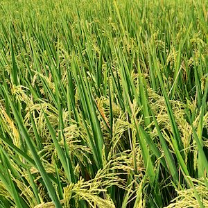
Satellite remote sensing (RS) offers an efficient, large-scale approach for monitoring crop health, particularly in precise estimation of crop yields. Rice is a staple food for over three billion people worldwide, making it crucial to estimate rice yield promptly to ensure food security and support sustainable agriculture. However, traditional field survey methods for yield assessment, are often labor-intensive, and time-consuming. To address this challenge, we propose a novel approach that integrates Gaofen-1 (GF-1) and Gaofen-6 (GF-6) multispectral data for monitoring and evaluating rice crop yield under different wheat residue cover (WRC) percentages. This method employed three Remote Sensing (RS) based vegetation indices (VIs): i) enhanced vegetation index (EVI), ii) normalized difference vegetation Index (NDVI), and iii) green normalized difference vegetation index (GNDVI), with field data collected from 80 sampling points across paddy fields in the Changshu County, China. The results demonstrated that land use and land cover (LULC) mapping effectively classified paddy fields, covering 66% of the study area, with a classification accuracy of 88% (κ = 0.84). Among the relationships tested between VIs and WRC, NDVI showed the highest correlation (R² = 0.66), followed by EVI (R² = 0.60) and GNDVI (R² = 0.51), confirming NDVI as the most effective index for yield modeling. The yield estimation model, based on peak NDVI values correlated with measured rice yield from the calibration dataset (n=52), achieved R² = 0.83 and validation with test data (n=28) showed high accuracy of R² = 0.88 with low error metrics (RMSE = 3.48% and MAPE = 2.35%). Additionally, the findings indicated that the highest rice yields (8.21-8.36 tons/ha) were observed at moderate WRC levels (60-75%) compared to other residue percentages. These outcomes suggest that an appropriate amount of WRC enhances rice yield by supporting moisture retention and nutrient availability, which optimizes overall crop performance.Therefore, we strongly recommend integration of Gaofen satellite data with NDVI could be a scalable, cost-effective solution for accurate yield prediction that supports sustainable residue management practices and precision agriculture.
Downloads
Citations
Supporting Agencies
Jiangsu Agricultural Science and Technology Innovation Fund, Jiangsu UniversityHow to Cite

This work is licensed under a Creative Commons Attribution-NonCommercial 4.0 International License.