UAV-SfM 4D mapping of landslides activated in a steep terraced agricultural area

Submitted: 15 October 2020
Accepted: 28 December 2020
Published: 18 March 2021
Abstract Views: 2479
PDF: 762
HTML: 59
Publisher's note
All claims expressed in this article are solely those of the authors and do not necessarily represent those of their affiliated organizations, or those of the publisher, the editors and the reviewers. Any product that may be evaluated in this article or claim that may be made by its manufacturer is not guaranteed or endorsed by the publisher.

Authors

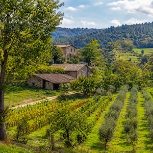
The presence of roads is closely linked with the activation of land degradative phenomena such as landslides. Factors such as ineffective road management and design, local rainfall regimes, and specific geomorphological elements actively influence landslide occurrence. In this context, recent developments in digital photogrammetry (e.g., Structure from Motion; SfM) paired with Uncrewed Aerial Vehicles (UAV) systems increase our possibilities to realize low-cost and recurrent topographic surveys. This can lead to the development of multi-temporal (hereafter: 4D) and high-resolution Digital Elevation Models (DEMs), which are fundamental to analyse geomorphological features and quantify processes at the fine spatial and temporal resolutions at which they occur. This research proposes a multi-temporal comparison of the main geomorphometric indicators describing a landslide-prone terraced vineyard to assess the observed high-steep slope failures. The possibility to investigate the evolution of landslide geomorphic features in steep agricultural systems through a high-resolution and 4D comparison of such indicators is still a challenge to be explored. In this article, we considered a case study located in the central Italian Alps, where two landslides were activated below a rural road within a terraced agricultural system. The dynamics of the landslides were monitored by comparing repeated DEMs (DEM of difference), which reported erosion values of above 20 m3 and 10 m3 for the two landslide zones and deposition values of more than 15 m3 and 9 m3, respectively. The road network’s role in the alteration of superficial water flows was proved by the elaboration of the relative path impact index. Altered water flows were expressed by values between 2σ and 4σ close to the collapsed surfaces. The increase in profile curvature and roughness index described the landslides evolution over time. Finally, the multi-temporal comparison of feature extraction underlined the geomorphological changes affecting the study area. The accuracy of features extraction was analysed through the quality index computation, expressed in a range between 0 (low accuracy) and 1 (high accuracy), and proved to be equal to 0.22 m (L1-pre), 0.63 m (L1-post), and 0.69 m (L2). Results confirmed the usefulness of high-resolution and 4D UAV-based SfM surveys to investigate landslides triggering due to the presence of roads at hillslope scale in agricultural systems. This work could be a useful starting point for further studies of landslide- susceptible zones on a wider scale to preserve the quality and the productivity of affected agricultural areas.

Dimensions

Altmetric

PlumX Metrics

Downloads

Download data is not yet available.

Citations

Bajocco S., De Angelis A., Perini L., Ferrara A., Salvati L. 2012. The impact of Land Use/Land Cover Changes on land degradation dynamics: A Mediterranean case study. Environ. Manage. 49:980-9. DOI: https://doi.org/10.1007/s00267-012-9831-8
Borga M., Tonelli F., Selleroni J. 2004. A physically based model of the effects of forest roads on slope stability. Water Resour. Res. 40. DOI: https://doi.org/10.1029/2004WR003238
Bordoni M., Vercesi A., Maerker M., Ganimede C., Reguzzi M.C., Capelli E., Wei X., Mazzoni E., Simoni S., Gagnarli E., Meisina C. 2019. Effects of vineyard soil management on the characteristics of soils and roots in the lower Oltrepò Apennines (Lombardy, Italy). Sci. Total Environ. 693:133390. DOI: https://doi.org/10.1016/j.scitotenv.2019.07.196
Bossi G., Cavalli M., Crema S., Frigerio S., Quan Luna B., Mantovani M., Marcato G., Schenato L., Pasuto A. 2015. Multi-temporal LiDAR-DTMs as a tool for modelling a complex landslide: A case study in the Rotolon catchment (eastern Italian Alps). Nat. Hazards Earth Syst. Sci. 15:715-22. DOI: https://doi.org/10.5194/nhess-15-715-2015
Brasington J., Langham J., Rumsby B. 2003. Methodological sensitivity of morphometric estimates of coarse fluvial sediment transport. Geomorphology 53:299-316. DOI: https://doi.org/10.1016/S0169-555X(02)00320-3
Cavalli M., Tarolli P. 2011. Application of LiDAR technology for rivers analysis. Ital. J. Engine. Geol. Environ. 1:33-44.
Cavalli M., Trevisani S., Comiti F., Marchi L. 2013. Geomorphometric assessment of spatial sediment connectivity in small Alpine catchments. Geomorphology 188:31-41. DOI: https://doi.org/10.1016/j.geomorph.2012.05.007
Cucchiaro S., Cavalli M., Vericat D., Crema S., Llena M., Beinat A., Cazorzi F. 2018. Monitoring topographic changes through 4D-structure-from-motion photogrammetry: application to a debris-flow channel. Environ. Earth Sci. 77:632. DOI: https://doi.org/10.1007/s12665-018-7817-4
Eker R., Aydin A. 2014. Assessment of forest road conditions in terms of landslide susceptibility: A case study in Yığılca Forest Directorate (Turkey). Turkish J. Agricult. Forestry 38:281-90. DOI: https://doi.org/10.3906/tar-1303-12
Evans I.S. 1979. An integrated system of terrain analysis and slope mapping: Final Report. Geomorphology 36:274-95.
Heipke C., Mayer H., Wiedemann C., Jamet O. 1997. Automated reconstruction of topographic objects from aerial images using vectorized map information. Int. Archiv. Photogramm. Remote Sens. XXXII:47-56.
Krebs P., Stocker M., Pezzatti G.B., Conedera A. 2015. An alternative approach to transverse and profile terrain curvature. Int. J. Geogr. Inf. Sci. 29:643-66. DOI: https://doi.org/10.1080/13658816.2014.995102
Lague D., Brodu N., Leroux J. 2013. Accurate 3D comparison of complex topography with terrestrial laser scanner: application to the Rangitikei canyon (N-Z). ISPRS J. Photogramm. Remote Sens. 82:10-26. DOI: https://doi.org/10.1016/j.isprsjprs.2013.04.009
Lanni C., Borga M., Rigon R., Tarolli P. 2012. Modelling shallow landslide susceptibility by means of a subsurface flow path connectivity index and estimates of soil depth spatial distribution. Hydrol. Earth Syst. Sci.16:3959-71. DOI: https://doi.org/10.5194/hess-16-3959-2012
Persichillo M.G., Bordoni M., Cavalli M., Crema S., Meisina C., 2018. The role of human activities on sediment connectivity of shallow landslides. Catena 160:261-74. DOI: https://doi.org/10.1016/j.catena.2017.09.025
Remondino F., Nocerino E., Toschi I., Menna F. 2017. A critical review of automated photogrammetric processing of large datasets. Int. Archiv. Photogramm. Remote Sens. Spatial Inf. Sci. 42:591-9. DOI: https://doi.org/10.5194/isprs-archives-XLII-2-W5-591-2017
Salvati L., Mavrakis A., Colantoni A., Mancino G., Ferrara A. 2015. Complex adaptive systems, soil degradation and land sensitivity to desertification: a multivariate assessment of Italian agro-forest landscape. Sci. Total Environ. 521:235-45. DOI: https://doi.org/10.1016/j.scitotenv.2015.03.094
Sidle R.C., Ziegler A.D. 2012. The dilemma of mountain roads. Nature 5:437-8.
Sidle R.C., Ziegler A.D., Negishi J.N., Rahim A., Siew R., Turkelboom F. 2006. Erosion processes in steep terrain - Truths,myths and uncertainties related to forest management in Southeast Asia. 224:199-225. DOI: https://doi.org/10.1016/j.foreco.2005.12.019
Sofia G. 2020. Combining geomorphometry, feature extraction techniques and Earthsurface processes research: the way forward. Geomorphology 355.
Tarolli P., Sofia G., Dalla Fontana G. 2012. Geomorphic features extraction from high-resolution topography: Landslide crowns and bank erosion. Nat. Hazards 61:65-83. DOI: https://doi.org/10.1007/s11069-010-9695-2
Tarolli P., Calligaro S., Cazorzi F., Dalla Fontana G. 2013. Recognition of surface flow processes influenced by roads and trails in mountain areas using highresolution topography. Eur. J. Remote Sens. 46:176-97. DOI: https://doi.org/10.5721/EuJRS20134610
Tarolli P., Sofia G., Calligaro S., Prosdocimi M., Preti F., Dalla Fontana G. 2015. Vineyards in terraced landscapes: new opportunities from lidar data. Land Degrad. Develop. 26:92-102. DOI: https://doi.org/10.1002/ldr.2311
Tucci G., Parisi E.I., Castelli G., Errico A., Corongiu M., Sona G., Viviani E., Bresci E., Preti F. 2019. Multi-sensor UAV application for thermal analysis on a dry-stone terraced vineyard in rural tuscany landscape. ISPRS Int. J. Geo-Inf. 8. DOI: https://doi.org/10.3390/ijgi8020087
Vericat D., Wheaton J. M., Brasington J. 2017. Revisiting the morphological approach: opportunities and challenges with repeat high-resolution topography. In: D. Tsutsumi, J.B. Laronne (Eds.), Gravel-bed rivers: processes and disasters, 1st edn. Wiley, Oxford, pp 121-158.
Webb N.P., Marshall N.A., Stringer L.C., Reed M.S., Chappell A., Herrick J.E. 2017. Land degradation and climate change: building climate resilience in agriculture. Front. Ecol. Environ. 15:450-9. DOI: https://doi.org/10.1002/fee.1530
Wheaton J.M., Brasington J., Darby S.E., Sear D.A. 2010. Accounting for uncertainty in DEMs from repeat topographic surveys: improved sediment budgets. Earth Surf. Process Landf. 35:136-56.
Westoby M.J., Brasington J., Glasser N.F., Hambrey M.J., Reynolds J.M. 2012. Structure-from-Motion’ photogrammetry: A low-cost, effective tool for geoscience applications. Geomorphology 179:300-14. DOI: https://doi.org/10.1016/j.geomorph.2012.08.021
Wilson J.P., Gallant J.C. 2000. Digital terrain analysis, in terrain analysis: principles and applications. John Wiley & Sons, New Yoyk, NY, USA.
Wood J. 1996. The geomorphological characterisation of digital elevation models. Ph.D. Thesis, University of Leicester, UK.
Yamazaki Y., Okazawa H., Sekiyama A., Fujikawa T. 2019. Accuracy Verification of UAV-SfM survey of terrace paddy fields in a hilly and mountainous area. IJERD Int. J. Environ. Rural Develop. 10:153-9.

How to Cite

Mauri, L., Straffelini, E., Cucchiaro, S. and Tarolli, P. (2021) “UAV-SfM 4D mapping of landslides activated in a steep terraced agricultural area”, Journal of Agricultural Engineering, 52(1). doi: 10.4081/jae.2021.1130.